Centuries-old Susquehanna petroglyphs give history a personal touch

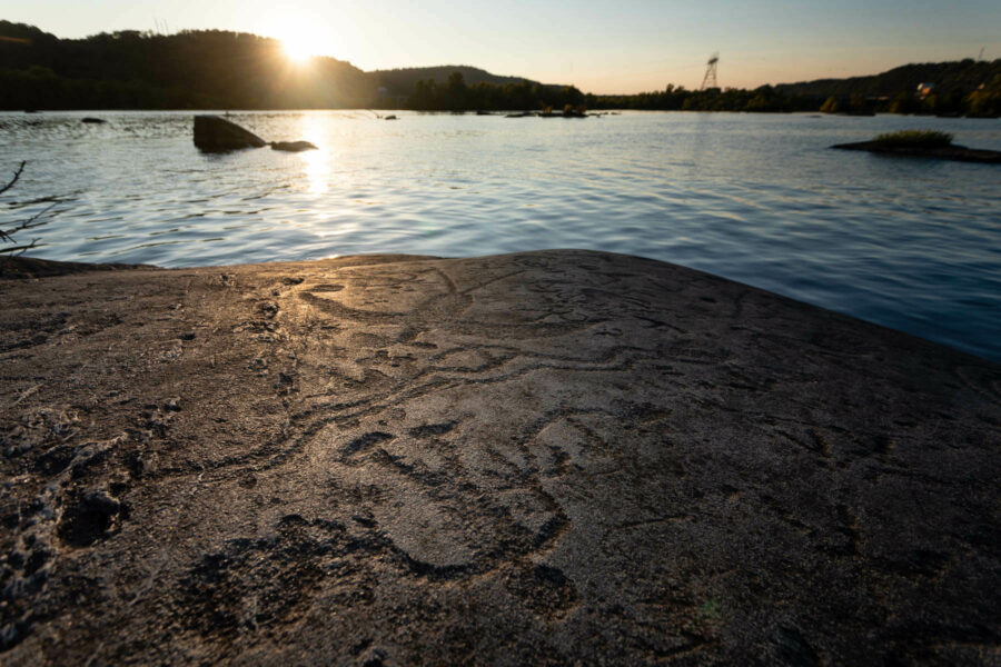
On a series of large rocks in the middle of the Susquehanna River, the story of the region’s inhabitants is etched in stone.
From about 1,000 to 500 years ago, the Algonquin-speaking Shenks Ferry people made carvings on river rocks at a handful of sites spanning about 30 miles from Wrightsville, Pennsylvania, to just over the Maryland border. The petroglyphs show an array of figures, including symbolic depictions of people, wildlife, spiritual connections and other information. When the Shenks Ferry people were displaced by the Susquehannocks around the year 1450, no more indigenous carvings were made in the area.
The nature of the rock—an extremely hard mineral known as granitic mica schist—has preserved many of the petroglyphs through centuries of weathering by floods and ice. The rock is so hard that just a small dot, known as a cupule, would take about 20 minutes to carve. This tells us that making each petroglyph took a very long time and held great meaning.
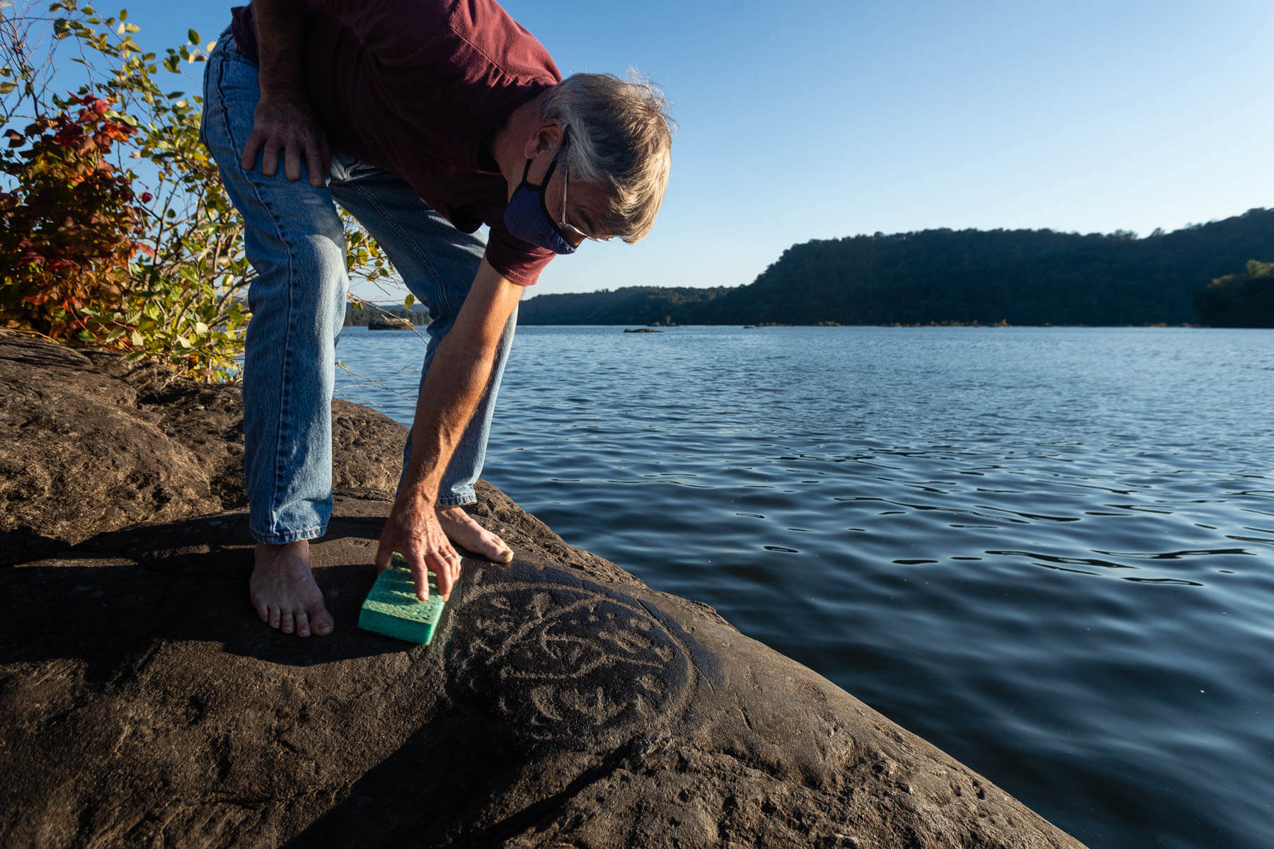
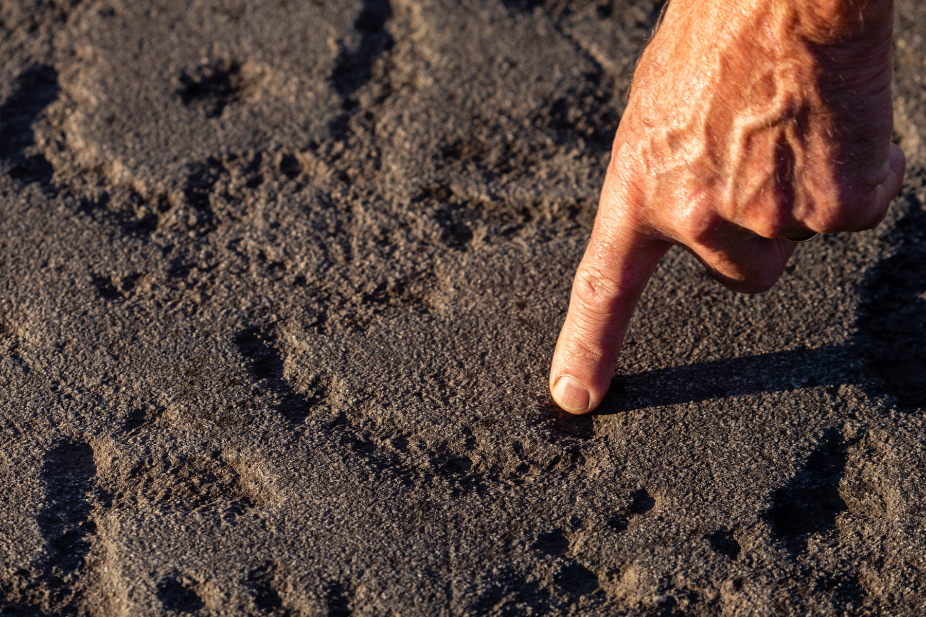
Petroglyph expert Paul Nevin uses a wet sponge to reveal detail in a collection of petroglyphs, including several animal tracks, an infant-sized human footprint and a serpent, all contained by a circle.

One October evening, petroglyph expert Paul Nevin steers his small boat to the rocks below Safe Harbor Dam on the edge of Lancaster County. Standing barefoot to avoid wear and tear on Big Indian Rock, he runs a wet sponge across the smooth stone canvas to reveal the detail in several carvings.
“It’s like entering a cave,” Nevin says. “At first you don’t see anything, then your eyes adjust.”
Within sight are other rocks with petroglyphs on them—impossible to distinguish at a distance—like Little Indian Rock and Turkey Track Rock.
Construction of the dam is known to have destroyed some petroglyphs, while others were removed or made into casts and placed in museums. Seven figures from Safe Harbor are reproduced on floor tiling inside the Pennsylvania State Capitol in Harrisburg. The construction of Safe Harbor, as well as the Holtwood and Conowingo dams downstream, also left many petroglyphs permanently submerged under higher water levels. At first it was assumed that none remained above water, but over the decades it became clear many were still visible.
Petroglyphs on the highest rocks were spared the flood, allowing Nevin—who has been studying the petroglyphs since the early 1980s—to make new discoveries. One realization came after Nevin consulted with an elder of the Mexica people in Central America, who suggested the long serpent forms on Little Indian Rock may mark important dates. Indeed, the serpents point to the sunrise and sunset on the winter and summer solstices.

“It’s really cool to be able to know that you can come out here on December 21 and at 7:36 in the morning the sun’s going to come up right there,” Nevin says.
Seven rocks below Safe Harbor hold about 300 petroglyphs, and ten sites in the lower Susquehanna total about 1,000 petroglyphs overall, making it the largest concentration of petroglyphs in the northeastern United States.
Little Indian Rock holds a massive assemblage of roughly 150 petroglyphs, and today, both that site and Big Indian Rock are on the National Register of Historic Places. It used to be that the location of the petroglyphs was more guarded but keeping the site well-maintained and raising awareness of their importance has proven to be a more effective means of avoiding damage. Nevin, who is also director of the nearby Zimmerman Center for Heritage, leads several tours each summer. Paddlers and boaters can reach the rocks on their own, provided they can navigate the shallow water.
Surrounding the petroglyphs is a view of mostly forested riverbank, though powerlines hint to the dam that lies just around the riverbend. It’s easy enough to mentally delete the signs of development and imagine what the rocks would have looked like centuries ago. Back then, with the water level naturally lower, they were surrounded by rapids.
Nevin says that many of the petroglyphs suggest that the rocks are sacred places where people would go to connect with the supernatural. Today, the petroglyphs also allow modern visitors to connect with the people who made them.
“When people want things to last for a long time, they do it in stone,” Nevin says, standing on Little Indian Rock as the setting sun starts to bring out more detail in the carvings. “So, these, I think, were placed on here to be here for a long time, for the people who came after the people who created them.”

Comments
Will Parsons is himself a valuable Chesapeake resource. The piece on petroglyphs was a revelation to me despite decades working on the Bay, There are OTHER petroglyphs near Little Cove Point on the middle Chesapeake, carved in limonite mineral stone by the water, but they all seem to be from the 1940s and perhaps connected originally to military training before the Normandy and Pacific Island invasions of WW-II.
Does anyone do tours of the petroglyph?
Little is known about their meanings but going to one of Nevins lectures is enlightening as he has done extensive research. The dam people that built the dam dams in the 1930’s did document as many of the petroglyphs as they could find but their speculation in comparing them to Chinese writing characters is comical. It’s a tragedy that that the dam building ruined this important site but any exact interpretation of the site was lost before white settlement. Only Nevins research has credible speculation about the importance of this place in the river.
Wait! So what do they mean?
And are they similar to those in GA and Yucatán?
Thank you!
Your comment has been received. Before it can be published, the comment will be reviewed by our team to ensure it adheres with our rules of engagement.
Back to recent stories