Getting to know the guardians of the Severn River

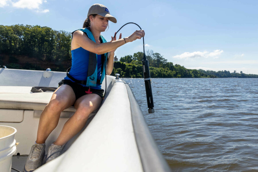
Standing at the helm of a skiff named Sea Girl, about an hour into a routine water quality monitoring trip, Tom Guay, executive director of the Severn River Association explained the story of a 16th-century astronomer named Tycho Brahe.
According to Guay, Brahe was famous for his fanatical approach to collecting large amounts of high-quality data. Before the telescope was even invented, Brahe made extensive astronomical observations that were so detailed that subsequent astronomers used them to debunk the theory that the sun revolved around the earth.
“We are the Tycho Brahes of water quality,” Guay said, capping off his story with a proud nod to his small team of water quality monitors, fondly known as the “WQ Crew”.
The metaphor about the team holds water. Each week from May to October, the ardent nonprofit—which holds claim to the “oldest river group in America”—visits 51 monitoring stations throughout the Severn River to generate profiles of the tributary’s various creeks and coves. They measure temperature, salinity, pH levels and dissolved oxygen at five different depths, and then note the water clarity using a simple yet effective tool called a secchi disk.
The information can tell you almost everything you want to know about the river’s health, including whether or not oysters can survive in the current conditions or when humans can safely swim. During the summer, the WQ Crew is on the lookout for repercussions from spring algae blooms, a notorious ecosystem agitator that’s brought on by an excess of nutrients entering the water.
“The algae blooms are double whammy,” said Guay. “First they block sunlight from reaching underwater grasses. Then [when they die off and decompose] they create dead zones which suffocate fish and crabs.”
When I asked how troublesome algae blooms this year were, science coordinator Mackenzie Miller indicated that things had improved.
“We’re seeing dead zones at the bottom, but it’s nothing compared to last year,” she said.

The reams of data collected by the river group play a vital role in the restoration of the Severn River, which is on the Environmental Protection Agency’s list of impaired waters. It is used to bolster regulatory, policy and legal decisions that reduce pollution, support enforcement actions against pollution contributors and even identify sources of pollution that the nonprofit didn’t know about. The data is also used in Bay and watershed-wide assessments such as the Chesapeake Bay Report Card and the Bay Barometer.
Profiling the 14-mile river also helps the nonprofit in its own restoration actions, namely their chief oyster programs, Marylanders Grow Oysters and Operation Build a Reef.
Towards the end of the trip, the WQ Crew took me to two different oyster reefs at Wade and Weem creeks. As explained by field investigator Emilia McGeady, before overharvesting and pollution demolished the oyster population, the sites were active fisheries, indicating that the locations are where oysters want to be.
Data is used to manage these reefs, but also to determine locations for future ones; according to Guay, the goal is to establish reefs up and down the river.
Above the oyster reef at Wade Creek, I find myself in control of the hand-held computer that reads out water quality scores. As McGeady begins measuring the bottom depth, I’m relieved to announce a score of 3.1 milligrams per liter (mg/L) of dissolved oxygen, which is above the 2 mg/L threshold of what would be considered a dead zone.
For at least the morning, Guay’s team has made a Tycho Brahe out of me.

Comments
There are no comments.
Thank you!
Your comment has been received. Before it can be published, the comment will be reviewed by our team to ensure it adheres with our rules of engagement.
Back to recent stories