Online tool will help restoration partners rebuild oyster reefs
But a new report indicates oyster restoration could be more effective under stronger harvest limits.
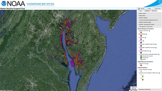
An online mapping tool is now available to help resource managers and restoration partners rebuild oyster reefs in the Chesapeake Bay.
Released this month by the National Oceanic and Atmospheric Administration (NOAA), the Oyster Decision Support Tool displays a range of information relevant to oyster restoration, from historic reef boundaries and maps of the seafloor to the rate of oyster disease, death and spatfall on bars in Maryland waters.

Over the past two centuries, native oyster populations have experienced a dramatic decline as habitat loss, disease and historic over-harvesting have taken their toll. But by filtering water, forming aquatic reefs and feeding countless watershed residents, the bivalves are an essential part of the Bay’s environment and economy.
The Chesapeake Bay Executive Order set a goal of restoring oyster reefs to 20 Bay tributaries by 2025, starting with Harris Creek on Maryland’s Eastern Shore.

But a new report from the University of Maryland Center for Environmental Science (UMCES) indicates that reef restoration could be more effective if paired with stronger harvest limits.
“Oysters should be able to come back if we help them out by reducing fishing pressure and improving their habitat,” said Michael Wilberg, Associate Professor at the UMCES Chesapeake Biological Laboratory, in a news release.
Dredging and tonging for oysters can damage reefs, pushing oysters onto unsuitable soft-bottom habitat or making them more vulnerable to suffocating sediment. According to the Wilberg-led study, if oysters were allowed to reproduce naturally and fishing were halted, it would take just 50 to 100 years for oyster abundance to reach as high a level as the Bay could support.
Learn more about the oyster population study.

Comments
There are no comments.
Thank you!
Your comment has been received. Before it can be published, the comment will be reviewed by our team to ensure it adheres with our rules of engagement.
Back to recent stories