Satellite image shows sediment pollution flowing into Chesapeake Bay
Plumes of sediment were observed flowing down the Susquehanna River into the Bay this week after heavy rains.
Plumes of sediment were observed flowing down the Susquehanna River into the Chesapeake Bay this week after the remnants of Tropical Storm Lee brought heavy rainfall to Pennsylvania and Maryland.
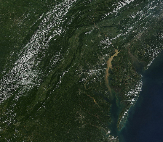
The large rainfall totals caused rivers to swell, washing dirt and pollution off the land and carrying it downstream to the Bay. Record flooding and water levels were recorded at Conowingo Dam on the Susquehanna River last week.
Image courtesy NASA/GSFC/MODIS
Comments
Stop the pollution of the Bethlehem steel.
The National Oceanic and Atmospheric Administration's CoastWatch program provides access to near real-time oceanographic satellite data. The East Coast Node, in particular, covers Maine to Florida, including the Chesapeake Bay: http://coastwatch.chesapeakebay.noaa.gov/
Where can I find current satellite images of the sediment cloud in the Chesapeake Bay?
Thank you!
Your comment has been received. Before it can be published, the comment will be reviewed by our team to ensure it adheres with our rules of engagement.
Back to recent stories