Thanks to federal investment, the Chesapeake Bay Program enters a new phase of water quality monitoring
New federal funding and partner investment enhance monitoring capabilities

Funding from the Infrastructure, Investment and Jobs Act (IIJA), along with support from other federal agencies, has temporarily enhanced the Chesapeake Bay Program’s monitoring efforts. The data that the partnership collects and analyzes charts the course for Bay restoration—determining whether the estuary is meeting the Environmental Protection Agency’s (EPA) water quality standards, and informing policy decisions that benefit streams and rivers across the Bay watershed. However, long-term investment is still needed to support this work into the future.
In March 2021, the Bay Program formed a team to review the gaps in its monitoring networks. Through a collaborative process with workgroups, federal and state agencies and nonprofits, the review team identified data collection needs, proposed methods for collecting the data and estimated costs for implementing monitoring plans. The team then communicated their findings to the partnership through a report and presentations, and hosted a series of meetings, starting in December 2022, to work on sustaining current monitoring networks into the future.
Using the IIJA funding, partners were able to keep the monitoring networks at their current funding levels for the next five years and fill in existing gaps. Our monitoring networks collect data ranging from water clarity and dissolved oxygen to underwater grass abundance and microorganisms—all of which require dedicated monitoring teams. However, IIJA funds are available for only five years, so partners are currently figuring out how to fund the networks beyond that time and enhance existing monitoring to secure its future.
In addition to this funding, the National Oceanic and Atmospheric Administration (NOAA), who is a key partner of the Bay Program’s monitoring networks, made an investment in new technology related to monitoring hypoxia (low oxygen) areas in the Bay.

Hypoxia is an economically and ecologically costly stressor for fish and other organisms in the Bay. However, hypoxic zones, which are measured by the levels of dissolved oxygen in the water, form more frequently than our monitoring is capable of capturing. Most Bay Program monitoring (including our annual hypoxia report) is designed to provide insight on annual and seasonal trends rather than daily or hourly trends.
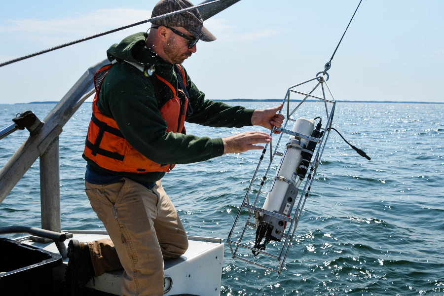
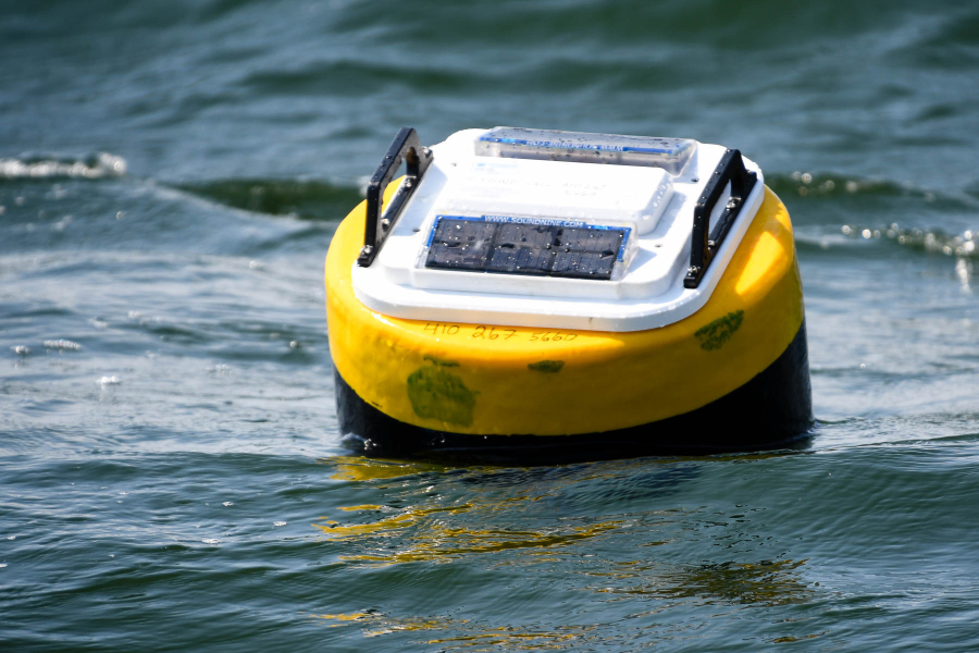
To overcome this gap, in 2020 the Bay Program funded and tested a portable, cost-effective method of measuring dissolved oxygen every 10 minutes in the open Bay. This pilot project was successful, and NOAA and EPA decided to invest additional IIJA funding to enhance our hypoxia monitoring network. Together with a collaborative team of fisheries managers and scientists, they planned out deployments of a total of 10 hypoxia monitoring stations over the course of 2023-2025. These will include both fixed and mobile monitoring stations.
Currently, we only have enough data to make broad assessments about hypoxia in the Bay. But with more frequent data in more areas of the estuary, we could determine if different tidal segments are suitable for specific uses, such as striped bass fishing, oyster farming or blue crab harvesting. With dissolved oxygen data coming in every 10 minutes, rather than every 14-28 days as it has traditionally, we'll be able to make better determinations of whether the organisms we count on to enrich our ecology, economy and cultural landscape can thrive. While we’re not quite there yet, with IIJA funding and partner investments we are closer than ever to obtaining the assessments that will get us to this point.
The upgrades to hypoxia monitoring will also improve the effectiveness of an innovative computer model called the 4-Dimensional (4-D) interpolator. Currently in the development phase by researchers in the Bay Program’s Bay Oxygen Research Group, this tool generates dissolved oxygen estimates across space and time. Interpolation means mathematically determining an unknown value from existing known values. The model is fed a lot of data to make interpolations that are as accurate as possible. More frequent data collected by the new monitoring stations will power the 4-D interpolator and allow it to make these more accurate estimations. Once complete, the interpolator will allow the Bay Program to provide finely tuned information on how close we are in different locations to meeting water quality standards.
With collaborative efforts to enhance monitoring like the hypoxia network, and innovative technological methods like the 4-D interpolator, the Chesapeake Bay Program is poised to break new ground in monitoring advancements over the next few years. Advancements in monitoring can tell us where our best efforts are having the most effect, where we need to improve our cleanup efforts, and how close we are to making the Bay and its watershed a bountiful place for all its inhabitants and ecosystems. Continuing to invest in our monitoring networks has never been more important, and never been more promising.

Comments
There are no comments.
Thank you!
Your comment has been received. Before it can be published, the comment will be reviewed by our team to ensure it adheres with our rules of engagement.
Back to recent stories