Three Chesapeake Gateways sites that capture the magic of the region
Celebrating 25 years of the National Park Service Chesapeake Gateways

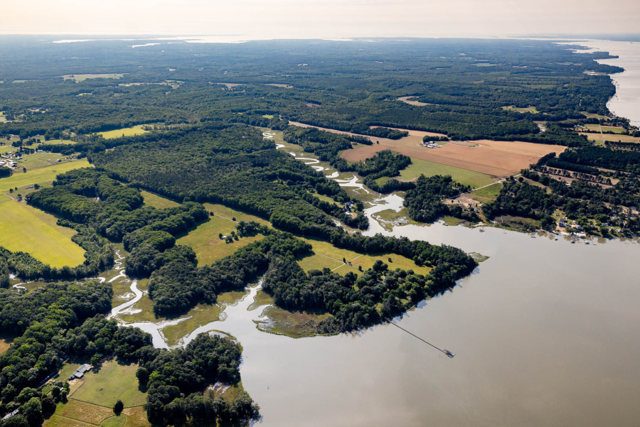
For 25 years, the National Park Service’s (NPS) Chesapeake Gateways has connected people to natural and cultural experiences within the Chesapeake Bay watershed, which spans 64,000 square miles! Since 2000, nearly 170 natural, cultural, historical and recreational sites, trails, museums, parks, refuges, and interpretive and orientation facilities have joined Chesapeake Gateways. These places serve as entry points for experiencing the Chesapeake Bay watershed and celebrate the region’s diversity.
Each site within the Chesapeake Gateways offers an array of interpretive materials, which may include enactments, workshops, videos, artwork, archeological displays, maps, guidebooks and more. Gateways sites are all about highlighting the multiple perspectives, vital stories, and welcoming trails, landscapes and waterways that comprise the Chesapeake Bay watershed.
In the mid-2000s, the Chesapeake Gateways led the effort to establish two nationally significant historic trails, one of which is the Captain John Smith Chesapeake National Historic Trail. It encompasses 3,000 miles and more than 15,000 years of culture. Each site along the trail demonstrates Chesapeake Gateways’ commitment to support and sustain environments that inspire and engage visitors, as they learn about the great outdoors, history, art and more!
Historic Jamestowne and Gloucester County Visitor Center

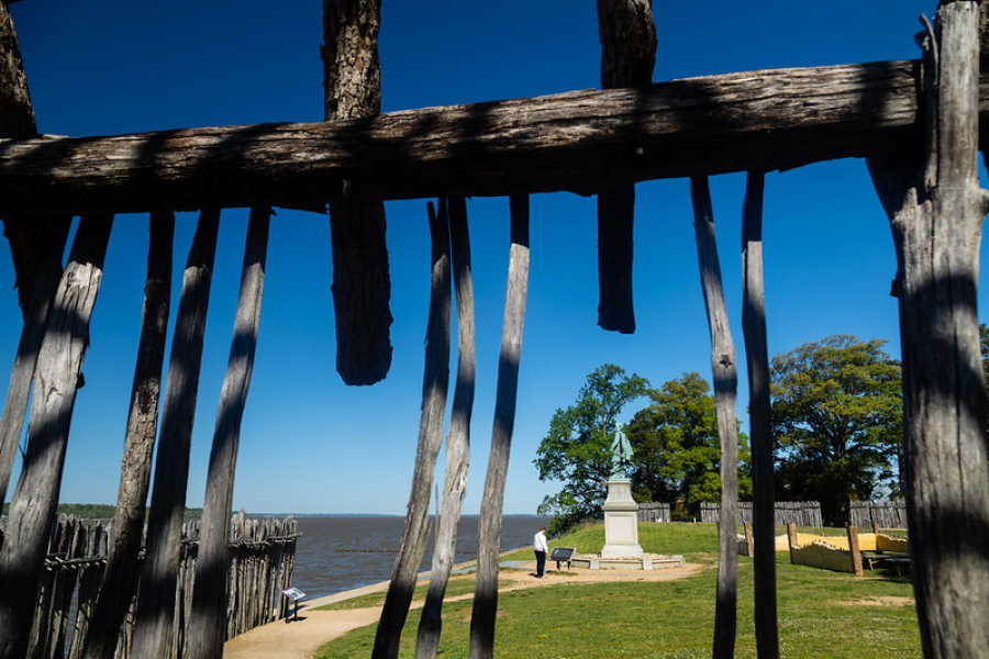
The first stop on the Captain John Smith trail—Historic Jamestowne and Gloucester County Visitor Center in coastal Virginia—is where the internationally famous archeological site known as Werowocomoco is located. For hundreds of years before Europeans first arrived, Werowocomoco was an important town whose name meant "place of leadership.” It includes the residence of Chief Powhatan and the site of the first meetings between Native leaders and English colonists. Werowocomoco was acquired and protected by the NPS as part of the Captain John Smith Trail in 2016 and is located just a few miles down the road from the Gloucester County Visitor Center.
At the Gloucester County Visitor Center, visitors are treated to a state-of-the-art experience! A stunning image of Werowocomoco etched in three panels of glass greets visitors. Other special features include a video on Werowocomoco, an interactive timeline of the development of the Virginia Indian tribes, the site itself and Gloucester County. A striking lenticular print image of Pocahontas rounds out this informative and artistic exhibit. "The lenticular image is printed on a special medium that is multi-faceted so that when the viewer moves, the image changes, giving it the feel of a hologram," said Katey Legg, director of Gloucester Parks, Recreation & Tourism. "It's a fantastic piece."
In addition, archeological artifacts from Werowocomoco, on loan from the Virginia Department of Historic Resources, can be found along a wall alongside touchscreens that display the artifacts in 3-D imagery. The touchscreens allow the visitor to "spin" the artifacts around to see all angles. An iconic conjectural image of Werowocomoco can be seen behind the artifacts. It shows an artist's bird's-eye view of Werowocomoco around the late 1500s, prior to the arrival of Europeans in present-day Virginia in 1607. This is a truly 21st century Chesapeake Gateways site using state of the art technology to create compelling, interactive, exhibits to educate visitors and honor the Indigenous peoples of the Chesapeake Bay watershed.
Sultana Education Foundation

Next on our stop is another fabulous Chesapeake Gateways site, The Sultana Education Foundation in northeastern Maryland.
The Sultana Education Foundation provides hands-on educational opportunities that promote stewardship of the Chesapeake Bay’s historic, cultural and environmental resources. By helping students of all ages develop an appreciation for the Chesapeake Bay, Sultana is working to create a community of individuals who are dedicated to preserving the Chesapeake Bay watershed.
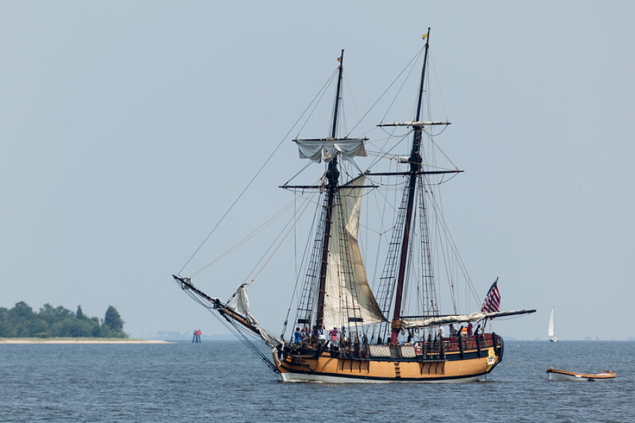
One of the many ways that Sultana engages visitors and students is through their use of the 1768 schooner SULTANA, an exciting and ultimate teaching platform for introducing students and other visitors to the history and environment of the Chesapeake Bay. The modern vessel is a full-scale reproduction of a 97’ topsail schooner that patrolled the mid-Atlantic enforcing the hated “Tea Taxes” for Britain’s Royal Navy in the years preceding the American Revolution. Aboard this unique tall ship, students work with the Sultana Education Foundation’s professional staff to trawl for fish and crabs, conduct tests to monitor water quality and learn about maritime life in the 18th century. Teachers can custom design programs that emphasize history, Chesapeake Bay ecology or a mix of both disciplines, and there are a multitude of curriculum aids available to provide students with pre- and post-trip activities.
In addition to the amazing array of educational opportunities that the Sultana Education Foundation provides for students of all ages, visitors can also enjoy the Chester River Water Trail and Sassafras River Water Trail as components of the greater Captain John Smith Chesapeake National Historic Trail. Both the Chester and Sassafras trails provide great opportunities for paddlers and small boaters to access and explore these two historic rivers. From the headwaters in Delaware to the river’s mouth between Kent Island and Rock Hall, Maryland, the Chester River Water Trail encompasses more than 100 miles of waterways, a variety of ecosystems and over 10,000 years of human history. Interpretative maps engage visitors with the history, the flora and fauna, the land and the waterways.
Zimmerman Center for Heritage
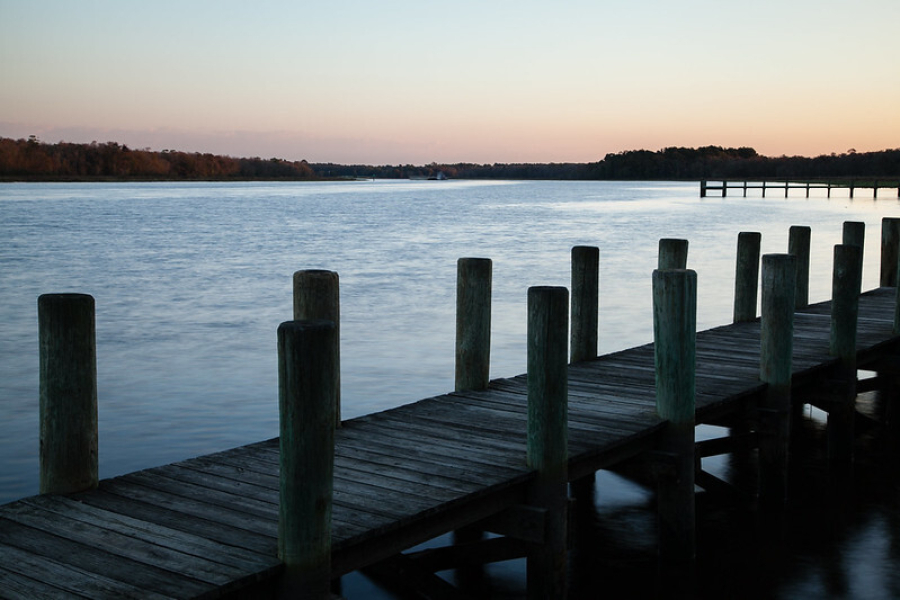
Our last stop on our tour of Chesapeake Gateways is the Zimmerman Center for Heritage in southeastern Pennsylvania. As part of the Lower Susquehanna Segment Plan for the Captain John Smith Chesapeake National Historic Trail, the Zimmerman Center for Heritage as the trail’s official Visitor Contact & Passport Station for Pennsylvania. Visitors can enjoy a hike to Native Lands County Park and the Mason-Dixon Trail, launch their kayaks or canoes, view the “Visions of the Susquehanna River” Art Collection, see Susquehannock Indian artifacts, learn about river history and attend a Heritage Lecture.
Restored and renovated by John and Kathryn Zimmerman in the late 1990s, this historic riverfront home dates to the mid-18th century. The Zimmermans donated the property to the Susquehanna National Heritage Area in 2007, when the home was opened to the public and officially dedicated as The John and Kathryn Zimmerman Center for Heritage in honor of their many contributions to the local community and region.
This Chesapeake Gateways site also publishes a paddler’s map and guide and maintains a system of river history panels for the Susquehanna River Water Trail-Lower Section, a National Recreation Trail along the river.

Partnerships and collaboration
Collaboration is a cornerstone of the Chesapeake Gateways partnership network, which benefits communities of the Chesapeake Bay watershed, along with the wildlife, land and millions of visitors who journey to the remarkable Gateway sites each year.
The NPS Chesapeake Gateways work continues! Prior to celebrating its 25th anniversary, the NPS Chesapeake Gateways developed a Strategic Plan and Updated Network Framework to continue the work of engaging all people who live, work and play in the Chesapeake Bay watershed. Join us in our efforts. Follow this link for opportunities to volunteer and contribute to the preservation of the Chesapeake Bay watershed!
References: Information and quotations in this article come from various NPS Chesapeake Gateways' publications and websites.

Comments
Very informative - great detail, photos, history. We will use it to plan an excursion. We learned so much. Thank you, Mary! Lynne & Ralph
What a great piece to highlight the many miles of trails and the natural beauty to take in! So inspiring! I appreciated the research and telling detail that fashioned such an interesting article. All of it was new to me, so thank you, Mary, for an article worth reading! We hope to use it to plan a trip!
Great article on an area I knew little about. The descriptions have inspired me to travel to the region and explore its history and natural beauty. I plan to use the article as a starting point.
Phenomenal photos and rich with information- a real contribution for travelers everywhere!
I never knew how much there is to explore via the Chesapeake Gateway! The NPS is a true gem of an organization in helping the nation preserve and make available to those wishing to have enriching experiences , especially for those of us living within a day's drive. Our heritage as seen through the lens of our county's natural beauty. I also must comment on the straight forward & engaging style the author, Mary, uses in her writing. Photos are fabulous too!
This article has inspired me to visit places in the Chesapeake Gateways region that I would not have previously been aware of or considered. I'd love to read and learn more about the thousands of years of human history and what better way to do that than to actually go see more of these beautiful waterways and trails. Thanks for a great read!
Inspiring piece -- excellent, detailed information. Already planning a visit to see the Sultana!
Thank you for this informative article. It serves as a travel guide as well as a historical reference to the area. I hope to use to plan an excursion. Beautiful photography too
What an inspiring model, to identify gateways of different types to highlight and teach about the natural and human features of watersheds. I hope to visit these sites some day and would love to see similar efforts made in watersheds like the Brandywine, Delaware, and Wissahickon where I live and work.
This was fascinating. It offers a very useful and informative introduction to the Chesapeake Gateways sites. I can't wait to visit!
Wonderful and informative, a beautiful read - thanks so much and look forward to more Mary!
Really enjoyed this article on the Chesapeake Gateways sites! Weve always wanted to visit this area and now with this abundant information, we look forward to planning a trip! Thank you!
Thank you!
Your comment has been received. Before it can be published, the comment will be reviewed by our team to ensure it adheres with our rules of engagement.
Back to recent stories