Chesapeake's underwater bay grasses decrease 21 percent in 2011
Extreme weather conditions in 2010 and 2011 led to a substantial decrease in bay grasses throughout the Bay and its rivers.
Fewer acres of bay grasses grew in the shallows of the Chesapeake Bay and its tidal rivers in 2011, according to scientists with the Chesapeake Bay Program. Bay grass acreage fell to an estimated 63,074 acres in 2011, down from 79,664 acres in 2010. This is the lowest Bay-wide acreage measured since 2006.

Because of heavy rainstorms that led to cloudy, muddy conditions that blocked monitoring efforts, only 57,956 acres of bay grasses were actually mapped in 2011. However, scientists believe about 5,119 acres of bay grasses may have been present during the height of the growing season, leading to the final estimated Bay-wide figure of 63,074 acres.
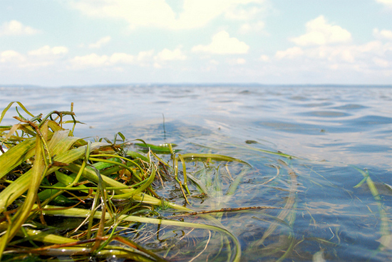
Bay grasses – also known as submerged aquatic vegetation or SAV – are a critical part of the Bay ecosystem. These underwater meadows provide fish, crabs and other aquatic life with food and habitat, absorb nutrients, trap sediment, reduce erosion, and add oxygen to the water. Bay grasses are also an excellent measure of the Bay's overall condition because their health is closely linked with the Bay’s health.
“2011 was the year that bucked two trends we’ve seen over the last decade,” said Lee Karrh, chair of the Bay Program’s Submerged Aquatic Vegetation (SAV) Workgroup. “The Upper Bay had major decreases after years of increasing or sustained high acreages. On the other hand, the brackish parts of the Middle Bay witnessed dramatic increases in 2011, after prolonged decreases since the turn of the century.”
Experts agree that extreme weather conditions in 2010 and 2011 led to the substantial decrease in bay grasses. According to Bob Orth, scientist with the Virginia Institute of Marine Science (VIMS) and coordinator of the annual bay grass survey:
- Summer 2010 was unusually hot, causing severe eelgrass die offs in the lower Bay. These beds had already been measured for the 2010 acreage survey, so these eelgrass losses were not officially recorded until 2011.
- In spring 2011, heavy rains and resulting runoff created very muddy conditions in the upper Bay and its rivers during the bay grass growing season.
- Last September, Hurricane Irene and Tropical Storm Lee brought even more rain and mud to the Bay’s waters.
In the upper Bay (from the mouth of the Susquehanna River to the Chesapeake Bay Bridge), bay grasses covered approximately 13,287 acres, down from 21,353 acres in 2010. This is most likely an underestimate because scientists did not monitor the area until November, once muddy conditions improved but well past the end of the growing season. One bright spot in the upper Bay was the more than doubling of bay grass acreage in the Chester River and near Eastern Neck.
In the middle Bay (from the Bay Bridge to Pocomoke Sound and the Potomac River), bay grasses decreased 4 percent to an estimated 34,142 acres, down from 35,446 acres in 2010. (Only 29,023 acres were mapped, but scientists estimate that an additional 5,119 acres may have been present.) Large eelgrass losses were observed in Tangier Sound. These were offset by widgeon grass gains in many areas, including Eastern Bay and the Choptank River.
In the lower Bay (south of Pocomoke Sound and the Potomac River), bay grasses covered 15,645 acres, down 32 percent from 22,685 acres in 2010. Hot summer temperatures in 2010 led to this significant drop in acreage, which offset any gains that followed in 2011. Eelgrass in many parts of the lower Bay had been recovering from similar heat-related losses that took place in 2005.
Despite Bay-wide losses, there were a few bits of good news for bay grasses last year. The huge, dense bed on the Susquehanna Flats – which has increased threefold in size over the past 20 years – survived the late summer tropical storms, showing how resilient healthy bay grass beds can be to natural disturbances. Also, scientists recorded the first-ever bay grass bed in the mainstem James River since the area was first surveyed in 1998.
Annual bay grass acreage is estimated through an aerial survey, which is conducted from late spring to early autumn. Residents can do their part to help restore bay grasses by not fertilizing in the spring and planting more plants to reduce polluted runoff from backyards.
For detailed information about 2011 bay grasses acreage, including aerial photos and year-to-year comparisons, visit VIMS' SAV blog. For more information about the aerial survey and bay grass monitoring efforts, visit VIMS’ SAV website.

Comments
I very sorry to hear the news of seagrass decrease in Chesapeake Bay
Thank you!
Your comment has been received. Before it can be published, the comment will be reviewed by our team to ensure it adheres with our rules of engagement.
Back to recent stories