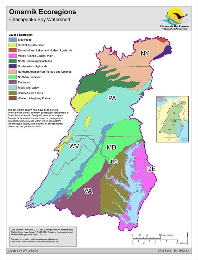
Omernik Ecoregions

- Author:
- John Wolf
- Date Created:
- February 12, 2008
The ecoregions shown in this map have been derived from Omernik (1987) and from subsequent refinements of Omernik's framework. Designed to serve as a spatial framework for environmental resource management, ecoregions denote areas within which ecosystems (and the type, quality, and quantity of environmental resources) are generally similar. The approach used to compile this map is based on the premise that ecological regions can be identified through the analysis of the patterns and the composition of biotic and abiotic phenomena that affect or reflect differences in ecosystem quality and integrity (Wiken 1986; Omernik 1987, 1995). These phenomena include geology, physiography, vegetation, climate, soils, land use, wildlife, and hydrology. Omernik, J.M. 1987. Ecoregions of the conterminous United States. Map (scale 1:7,500,000). Annals of the Association of American Geographers 77(1):118-125. Omernik, J.M. 1995. Ecoregions: A spatial framework for environmental management. In: Biological Assessment and Criteria: Tools for Water Resource Planning and Decision Making. Davis, W.S. and T.P. Simon (eds.) Lewis Publishers, Boca Raton, FL. Pp. 49-62. Wiken, E. 1986. Terrestrial ecozones of Canada. Environment Canada. Ecological Land Classification Series No. 19. Ottawa, Canada.
