Eleven lighthouses in the Chesapeake Bay watershed
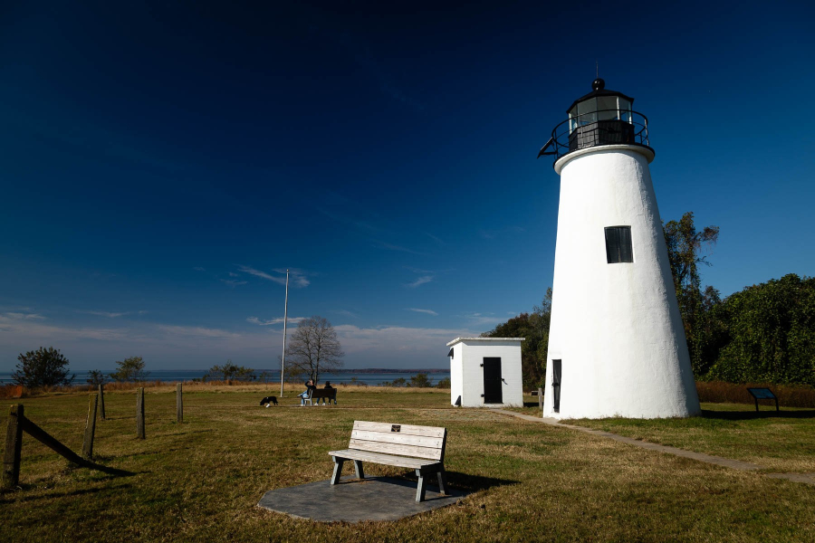
For more than 11,000 years, humans have lived in the Chesapeake Bay region. And for more than two hundred years, lighthouses have helped them navigate the waters of the Bay. Since the first lighthouse was placed at Cape Henry in 1792, 74 lighthouses have dotted the shores of the watershed, guiding wooden vessels, steam-powered boats and cargo ships through the Bay’s channels and around its obstacles. Today, more than 30 of these lighthouses still stand—and 23 still aid navigation. To whet your appetite for the region’s maritime history, here are 11 lighthouses in the watershed today.
Turkey Point
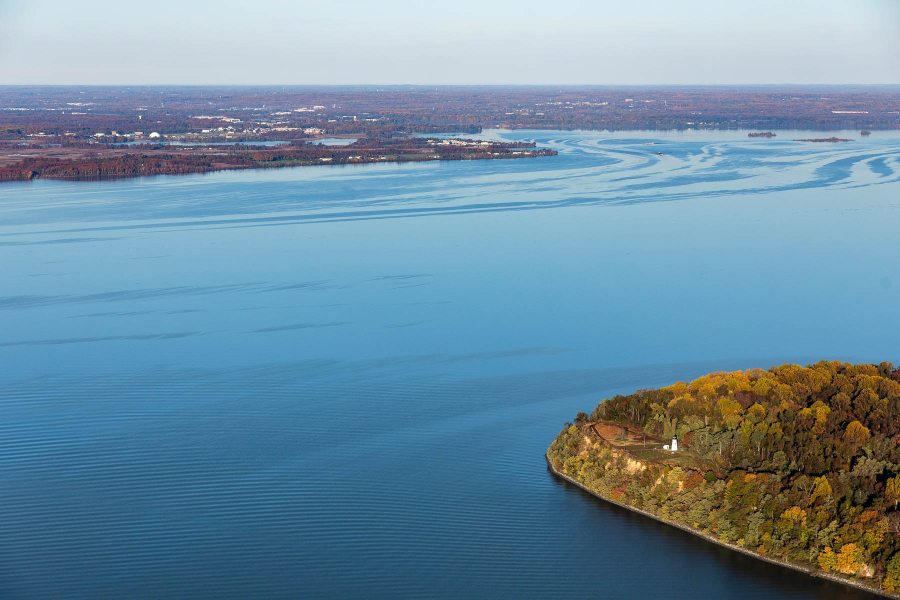
Located in Cecil County, Maryland, the Turkey Point lighthouse marks the point where the Elk and Northeast rivers enter the Chesapeake Bay. At 38 feet high, the conical structure was built by Havre de Grace resident John Donohoo in 1833. Between 1928 and 1947, the light was maintained by Fannie Salter, America’s last civilian female lighthouse keeper. The light was automated in 1947, deactivated in 2000 and re-lit two years later as a private aid to navigation. In 2006, the Maryland Department of Natural Resources (DNR) took ownership of the light, and it is estimated that 40,000 tourists visit the signature landmark of Elk Neck State Park each year. The lighthouse is open to visitors from April through November.
Sandy Point Shoal
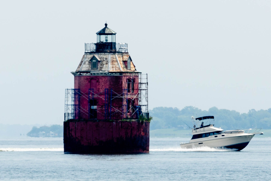
The first lighthouse to stand in this location—an onshore brick tower built in 1858—was replaced in 1883 with the structure that stands today. Located offshore of Sandy Point State Park and about 1.5 miles north of the Chesapeake Bay Bridge, the eight-sided, red brick tower is owned and maintained by the U.S. Coast Guard. Standing in 5 to 7 feet of water, the structure marks the shoals at Sandy Point. It was electrified in 1929 and automated in 1963.
Sharps Island
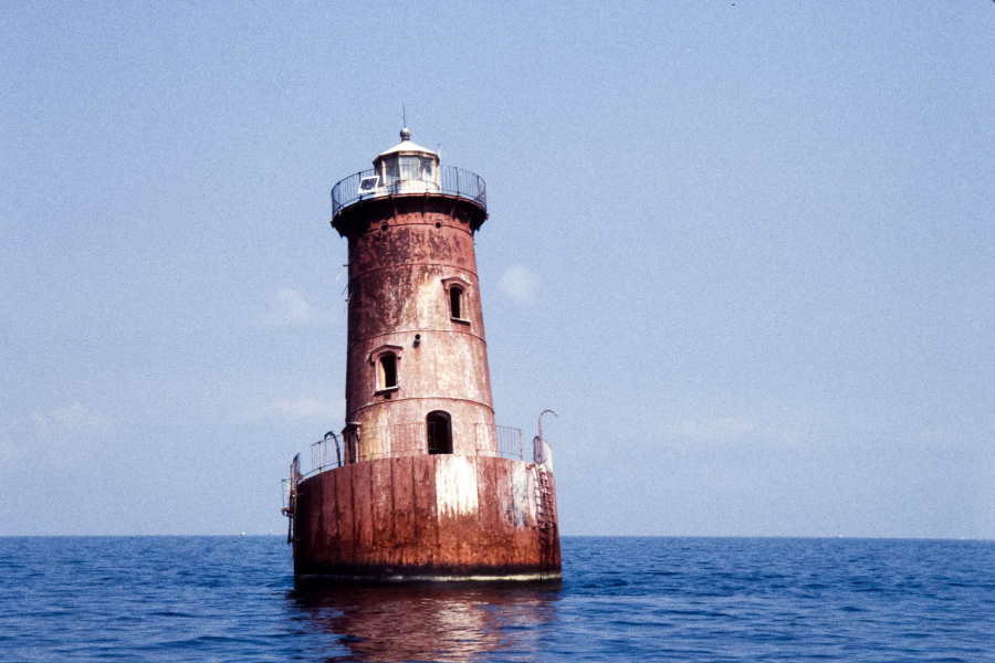
The 900-acre island that gave this lighthouse its name in 1838 disappeared shortly after the structure was built, succumbing to wind, waves and erosion. In 1866, the original light was replaced with a screwpile structure, which was pulled from its foundation by floating ice fields just 15 years later. A caisson structure was placed on the site in 1882, and while it still stands today, it did suffer an ice-induced tilt in 1976. Located offshore of Tilghman Island, the light marks the entrance to the Choptank River and the shoals off Poplar Island and Black Walnut Point.
Bloody Point Bar
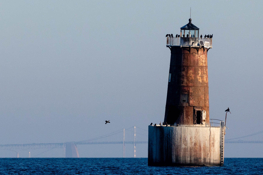
Located off the southern tip of Kent Island, this rust brown, iron structure was built in 1882 and marks the entrance to Eastern Bay. Just one year after its construction, severe storms pulled sand out from under the structure’s northwest side, causing a severe tilt. In 1885, 760 tons of stone were piled at the lighthouse’s base, which have kept it upright to this day. In 1960, an electrical fire destroyed the keeper’s quarters and the lens. Ever since, the light has been automated.
Cove Point

Built in 1828 by John Donohoo, the Cove Point lighthouse is the oldest continuously operating lighthouse in Maryland. The conical brick tower marks the entrance to the Patuxent River, and in October of 2000 it and its keeper’s house were transferred to the Calvert Marine Museum. Here, visitors can tour the light from May through September and rent out the renovated dwelling for vacations and special events. Because the light is still an active aid to navigation, the U.S. Coast Guard remains responsible for its operation.
Drum Point
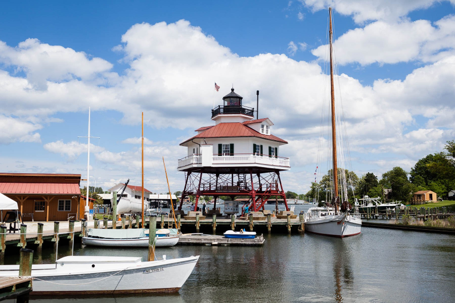
Like Cove Point, the Drum Point lighthouse sits at the Calvert Marine Museum, where it is open to the public year-round. Built in 1883, the light was decommissioned in 1962; in 1975, it was moved from the mouth of the Patuxent River to its present spot along the museum’s waterfront. The hexagonal wooden structure on top of a wrought-iron screwpile base is one of three remaining lighthouses built in this style, from the 45 that once served the Chesapeake Bay.
Point Lookout
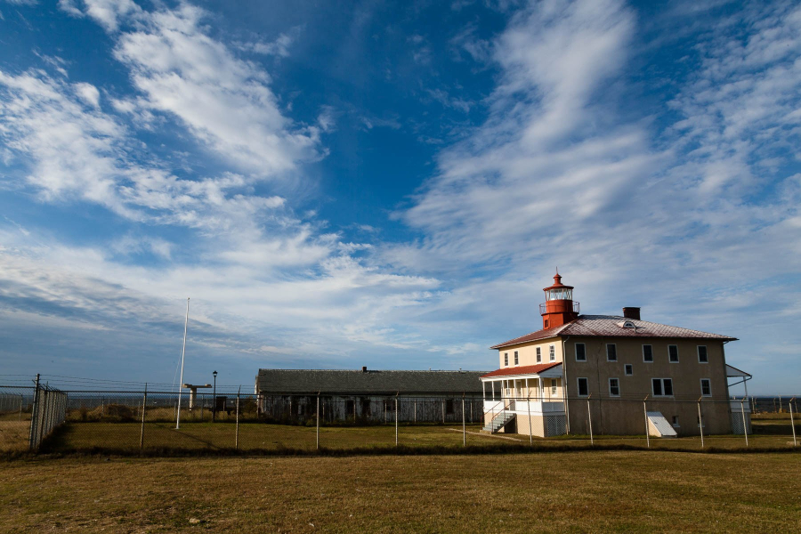
Built by John Donohoo in 1830, the Point Lookout lighthouse marks the north entrance to the Potomac River. Just three decades after the light’s construction, the point was transformed by the Civil War. In 1862, the point became home to a Civil War hospital; soon after, a camp was built that would come to hold 20,000 prisoners of war. Deactivated in 1965, the light was turned over to the U.S. Navy before becoming part of Point Lookout State Park in 2006. Said to be one of the most haunted lighthouses in America, members of the Point Lookout Preservation Society hold paranormal investigations to raise funds and offer tours of the light from April through November.
Point No Point
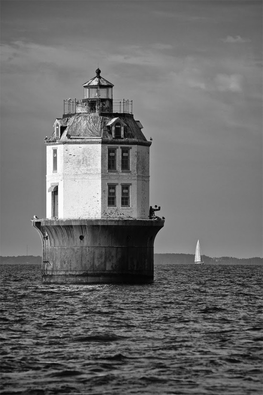
The Point No Point lighthouse sits six miles north of the Point Lookout lighthouse and the entrance of the Potomac River. While construction began in 1901, it was not completed until 1904. During a storm in 1903, a temporary construction pier collapsed and winds pushed the caisson structure 40 miles south to the Rappahannock River. In 1904, ice floes dislodged a second construction pier, delaying progress once again. Today, a two-story white tower sits atop a red, cast-iron base. Automated in 1938 and converted to unmanned operation in 1962, the light remains an active aid to navigation.
Cape Charles

Marking the northern side of the entrance to the Chesapeake Bay, the original Cape Charles lighthouse was built in 1828, but destroyed during the Civil War. A 150-foot brick replacement was built in 1864, but succumbed to floods and shoreline erosion about three decades later. The fully automated, 191-foot, cast-iron skeleton tower that stands today was erected in 1895, and is the second tallest lighthouse in the United States.
Wolf Trap
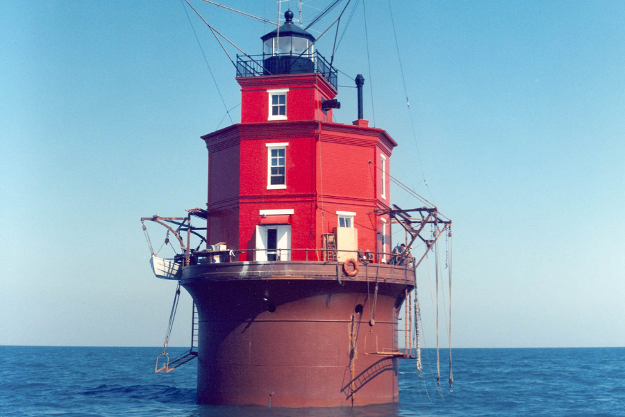
The first lighthouse to mark the shoals of Wolf Trap near the mouth of the Rappahannock River was built in 1870 to replace the lightships that had been in service here since 1821. In 1893, ice floes dislodged the light from its foundation. A replacement was built in 1894; its red, octagonal tower stands 52 feet tall.
Chesapeake Light
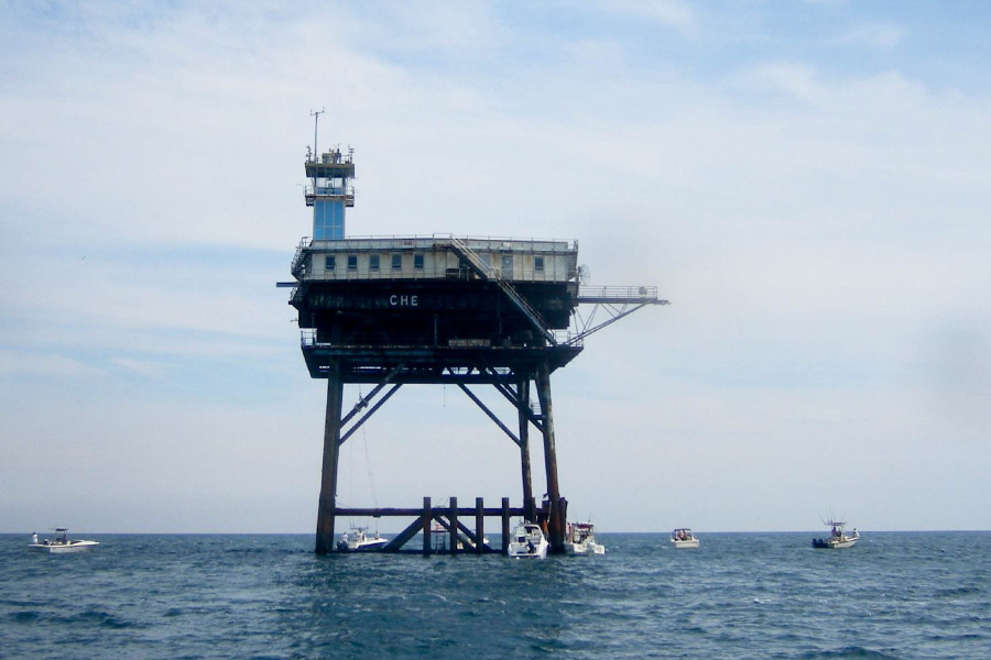
Built in 1965 to replace the lightship Chesapeake, the Chesapeake Light Station marks the entrance to the Chesapeake Bay, which has been lighted for mariners since 1933. The blue “Texas tower” sits on steel piles and resembles an oil drilling platform; a rooftop landing pad allows for helicopter access. Automated in 1980, the U.S. Coast Guard considered demolishing the station in 2004, but because it was still structurally sound, it remains an active aid to navigation.
Looking for more lighthouse knowledge? Find it on the Chesapeake Bay Gateways Network or LighthouseFriends.com! And find more Chesapeake sights on our Pinterest board.

Comments
is there a map where the lighthouses are marked
You left out the oldest lighthouse on the Cheasapeake
Pooles Island Light , a lot of history there.
Chesapeake Light decommissioned August 2018 due to structural deficiencies.
Please note the photo posted for Cape Charles Lighthouse is actually the Cape Charles town water tower.
Thank you!
Your comment has been received. Before it can be published, the comment will be reviewed by our team to ensure it adheres with our rules of engagement.
Back to recent stories