Is the Chesapeake Bay’s water rising or is the land sinking?
How the Chesapeake Bay is susceptible to both sea level rise and land subsidence.
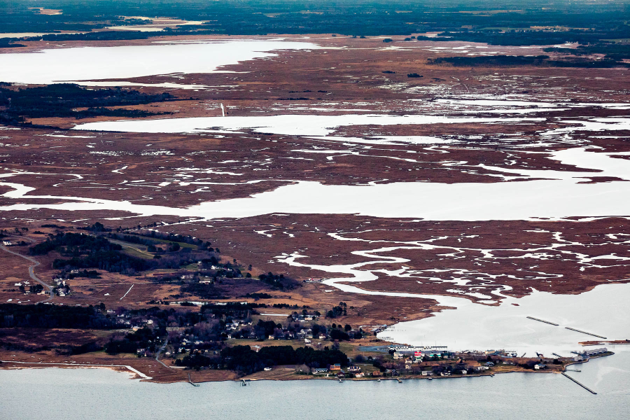
The Chesapeake Bay has a higher land-to-water ratio than any estuary in the world, making it incredibly vulnerable to adverse impacts from sea level rise.
Sea level rise, or the increase of the Earth’s water levels due to global warming, is generally known to have two causes: thermal expansion and the melting of ice sheets.
Thermal expansion occurs when the temperature of the Earth’s atmosphere increases and warms up the Earth’s waters. When water heats up, it expands, which results in higher sea levels. Sea level rise can also be caused by melting ice, as rising temperatures can trigger large glaciers and ice sheets around the world to melt at faster rates and move more quickly into the Earth’s oceans.
However, thermal expansion and melting ice are not the only reasons we see rising waters in the Chesapeake Bay area. There is also a process known as land subsidence, which is the sinking of the Earth’s surface due to changes that happen underground. As land sinks, the water in the Bay rises.
While land subsidence can have natural causes, such as glacial isostatic adjustment or structural faults, it can also be caused by human activities. The underground removal of water, oil, natural gas or mineral resources by pumping, fracking or mining, can result in faster rates of land subsidence. In the Chesapeake Bay, more than half of the estuary’s land subsidence is estimated to be from excessive groundwater removal. When groundwater is removed, typically to support drinking water and agricultural needs, the clay and silt underground get compacted which causes the land to sink.
Scientists measure the change of rising waters relative to rising or sinking land with a metric called “relative sea level rise.” In contrast, “absolute sea level rise” measures the height of global water levels relative to the Earth’s center without taking land subsidence into account. Over the past century, the relative sea level in the Chesapeake Bay area has risen twice as fast compared to the global rate, presumably due to land subsidence. According to the Chesapeake Sea Level Rise and Storm Surge Awareness and Response (CSSPAR) team, land subsidence contributes to about half of this estimate, while the other half is due to melting ice.
Land subsidence and sea level rise in the Chesapeake Bay region are predicted to continue at a significant rate into the future. According a study from The U.S. Geological Survey, moderate predictions of that Bay’s relative sea level rise range from 1.3 feet (0.4 meters) to 5.2 feet (1.59 meters) by the end of this century.
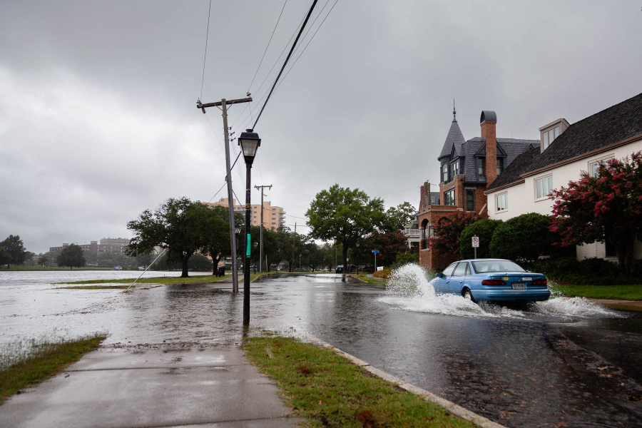
While a few more feet of sea level rise may not seem like a big deal, it can have devastating effects on coastal habitats and communities. Higher water levels in the Bay can result in more frequent flooding and intense storms, increased coastal erosion, contamination of soils and groundwater with salt, loss of tidal wetlands and the destruction of ecologically important habitats for many birds, fish, shellfish and plants.
Flooding and stronger storm surges can also displace many communities and homes. The CSSPAR team predicts that at the current rate of sea level rise, “the Bay would invade the land for miles in some places, destroying 167,000 acres of marshland and three million people’s homes by the year 2100.” The most at-risk areas include low-lying coastal communities – for example, Chesapeake, Hampton, Virginia Beach and Maryland’s Eastern Shore—but also major cities, such as Washington, D.C., Baltimore and Norfolk, among others. All of these communities are working to both mitigate and adapt to the impacts of sea level rise. Norfolk, Virginia’s Vision 2100 Plan includes various climate resiliency efforts that incentivize developers to prepare for flooding, while Washington, D.C. has included in its Climate Ready Plan a mix of grey and green infrastructure that’ll curb flooding in its communities.
As both global sea level rise and local land subsidence continue to increase the rate at which our Bay is rising, our efforts to mitigate climate change and structure resilient communities is more important than ever.
Comments
I believe Lower Hoopers Island had substantially subsided to the point humans abandoned it to sheep before the Industrial Revolution, before significant drawdown for irrigation,...
First learned of bay subsidence while flying over Virginia peninsula yesterday. Pleased to find information so clear and concise explaining its cause and relevance to other climate change issues.
I wasn't aware of the land subsidence issue in regard to coastal flooding, either. That is helpful to know. Thank you.
I wasn't aware that land subsidence is as critical a problem as this article describes. Thanks for pointing that out.
Thank you!
Your comment has been received. Before it can be published, the comment will be reviewed by our team to ensure it adheres with our rules of engagement.
Back to recent stories