Maps
Browse through maps depicting Bay health and restoration, including pollution trends, public access sites and more.
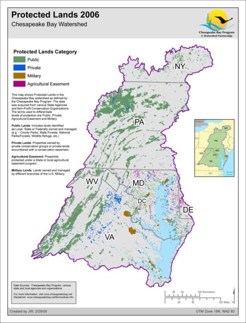
Protected Lands 2006
Date created: February 28, 2008This map shows Protected Lands in the Chesapeake Bay watershed as defined by the Chesapeake Bay Program. The data was acquired from various State Agencies and Non-Profit Conservation Organizations. The terms used to differentiate levels of protection are Public, Private, Agricultural Easement and Military. Public Lands: Includes lands identified as Local, State or Federally owned and managed. (e.g. - County Parks, State Forests, National Parks/Forests, Wildlife Refuge, etc.) Private Lands: Properties owned by private conservation groups or private lands encumbered with a conservation easement. Agricultural Easement: Properties protected under a State or local agricultural easement program. Military Lands: Lands owned and managed by different branches of the U.S. Military.
View map